Live weather radar, play it forward
Watch rain, storms, and lightning move across the map, then play the radar timeline forward to see where they are heading.

Severe Thunderstorm Warning
now
Dallas County, TX. Take cover now, away from windows.
Severe Thunderstorm Watch
18m ago
Severe thunderstorm conditions are possible near a place you saved.
What is a live weather radar?
A live weather radar is a map that shows where precipitation is falling and how heavy it is, animated as the storm moves. Hurricane puts that radar on your iPhone, with a radar timeline you can play forward to see where the rain is heading.
Live radar
Map layers
Radar timeline
Reading the radar
How to read a weather radar
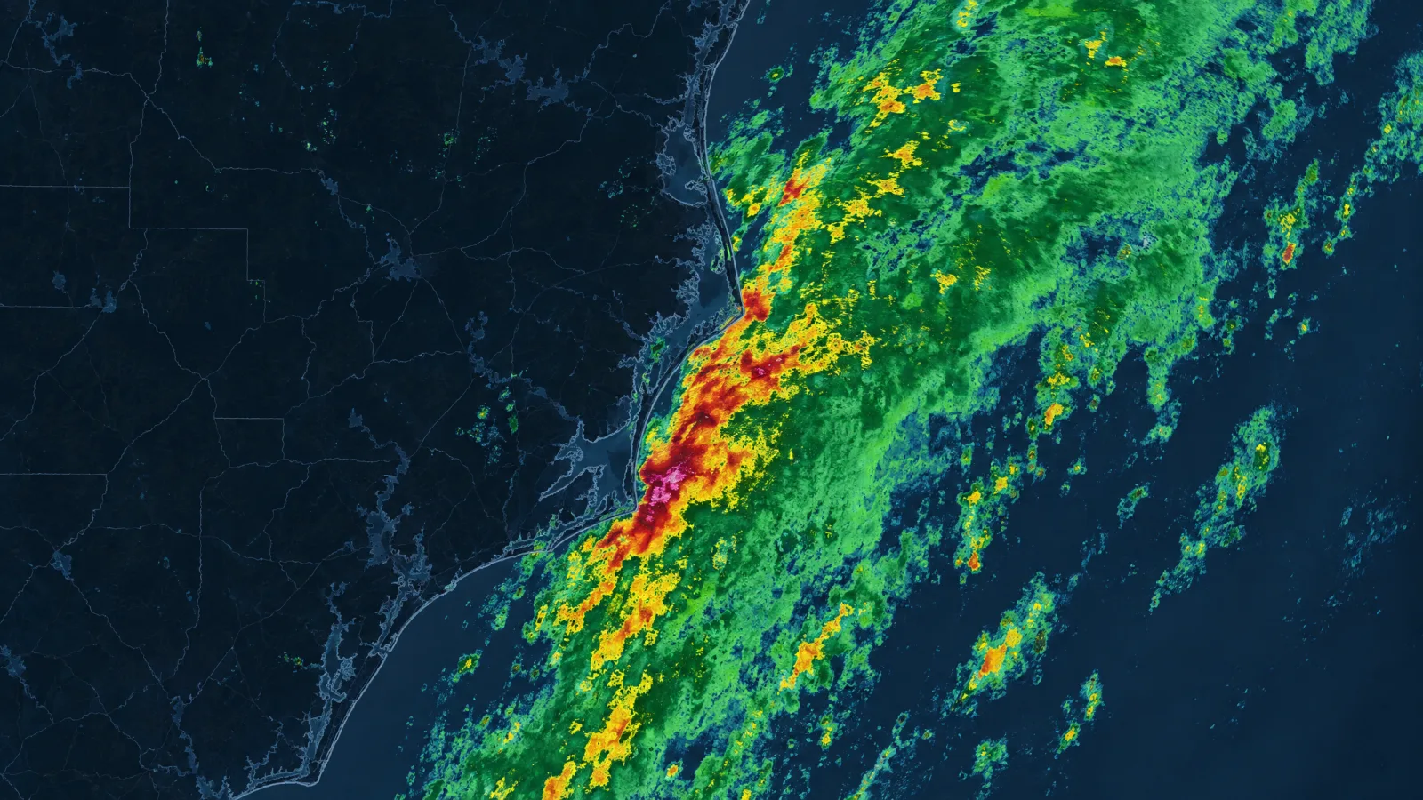
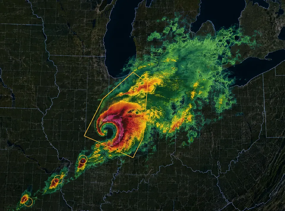
A weather radar map shows where precipitation is falling, and the colors show how heavy it is. Green is light, yellow and orange are heavier, and red and magenta mark the strongest cores of a storm. Color is about intensity at that moment, not how much rain has already fallen. The hurricane tracking map and the tornado tracker use the same colors, so the scale you learn here works everywhere in the app.
Start at your location. Read the color for intensity. Play the timeline to see direction: one frame tells you where the rain is; the animation tells you where it is going. Then look at the shape. A long line of cells usually moves as a front. A tight, bright core is a stormcell worth watching.
Color on the radar map
What it usually means
Light green
Very light. Drizzle, or rain you barely notice.
Green
Light to steady rain. Rain you want a jacket for.
Yellow
Moderate. Heavy enough to slow traffic.
Orange
Heavy. Downpour.
Red
Very heavy. The core of a storm, gusty wind.
Magenta
Most intense returns. Hail is possible.
Live radar
See live weather radar and every map layer
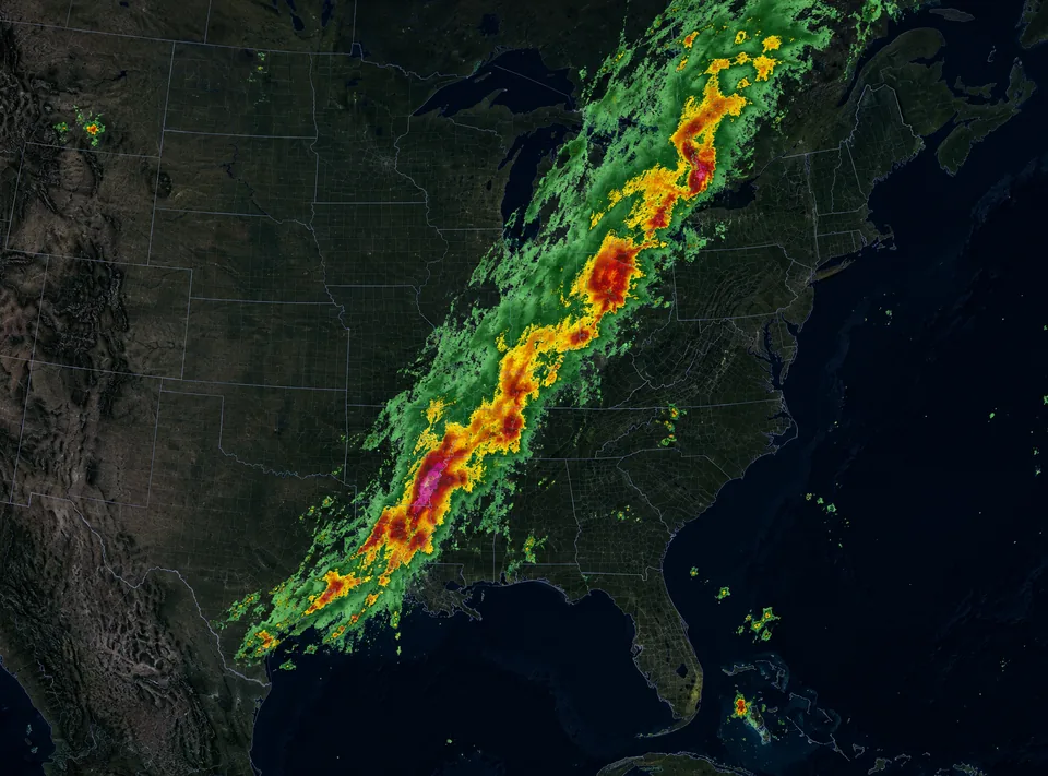
The radar layer shows precipitation on the map, and the timeline turns that into motion. Drag it back to see where the rain has been, or play it forward to see where it is going. Radar is also one layer of many: wind, lightning, stormcells, temperature, air quality, pollen, snow depth, and active fires sit on the same map, and tropical cyclones draw their track over it. Combine the layers you need instead of switching between apps.
Tap any point on the map for conditions at that exact spot, and save the places you check often so they are one tap away.
Layer
What it shows
Radar / Radar Global
Precipitation, with the animated timeline (Radar: United States · Radar Global: worldwide)
Precipitations
Precipitation with a forecast
Lightning
Lightning strikes (Coverage: United States, Canada, Europe)
Wind Animation
Wind speed and direction (Coverage: worldwide)
Tropical Cyclones
Storm path, category, details on tap
Alerts
Active weather alerts on the map
Stormcells
Individual stormcells, with rotating ones marked
Saffir-Simpson scale
Cat 1
Cat 2
Cat 3
Cat 4
Cat 5
Category 3 and above is classified as a major hurricane.
Hurricane tracking
When the radar picks up a cyclone
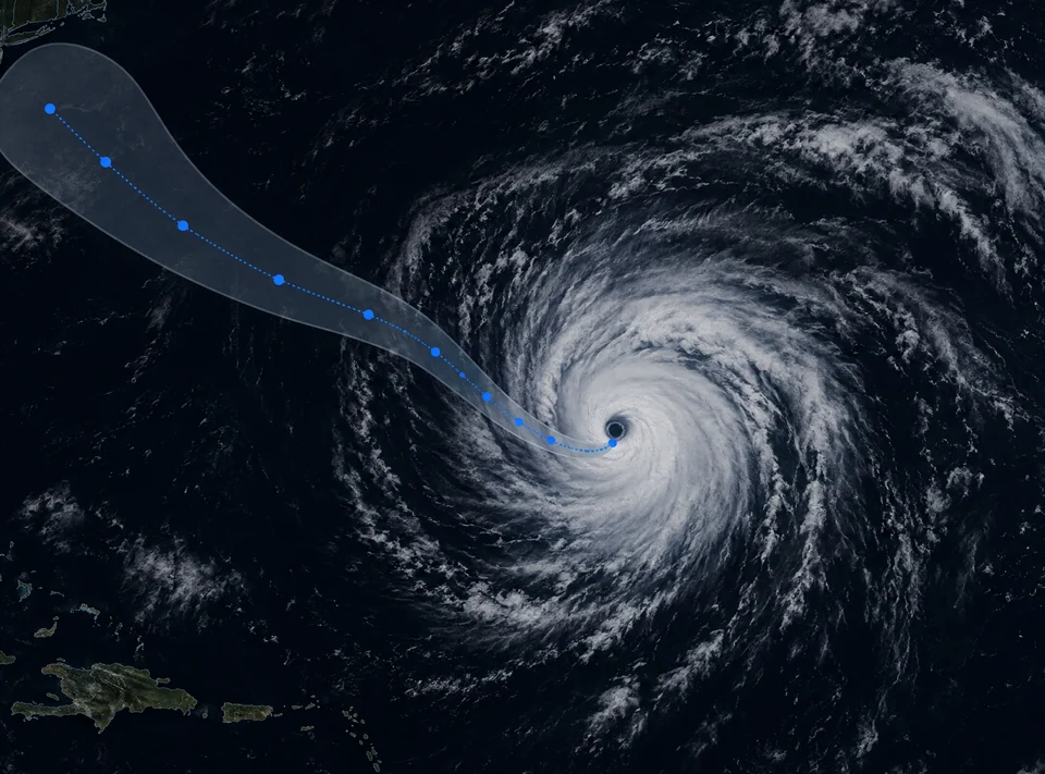
A tropical cyclone is bigger than one radar frame. The hurricane tracking map draws its forecast path over the same basemap you use for rain, with the cone that shows how much that track could still change.
Tap a storm to open its details, including its category on the Saffir-Simpson scale and where it is heading next.
Explore the hurricane tracking map
Tornado
When a cell on the radar starts rotating
Radar shows you the rain. The Stormcells layer shows which part of it is turning, so a line of storms stops being one shape and becomes individual cells you can follow.
A hook on the radar and a tight magenta core are the signature worth watching. When a warning is issued, the area it covers is drawn over the cell it applies to.
See how tornado tracking works
What a tornado alert means
Tornado Watch
Tornado Warning
Tornado Warning
now
Dallas County, TX. Take shelter now, away from windows.
Hurricane Watch
12m ago
Miami-Dade County, FL. Hurricane conditions are possible.
How the National Weather Service ranks an event
Advisory
Watch
Warning
happening, or about to
Severe weather alerts
When the radar turns into a warning
Watching the radar is one thing. Being told is another. Save the places that matter and Hurricane sends a push notification when an alert is issued for one of them.
Severe weather alerts cover severe thunderstorms and tornadoes, along with winter storms, ice, extreme heat and cold, wildfire danger, and air quality. In the United States, alerts are sourced from NOAA and the National Weather Service.
See every alert type we cover
What people say
I truly appreciate having access to this information when I need it. I am responsible for two senior care homes and this weather tracker helps me stay informed and in control.
mvlgg
App Store
Nicely integrates multiple wether elements, radar returns, wind, frontal boundaries to give a dynamic presentation of weather
daytexas
App Store
This app works great, accurate forecast, easy to view and understand, wonderful instant weather viewing
Chinger12
App Store
Frequently asked questions
What do the colors on a weather radar mean?
Colors show how heavy the precipitation is at that moment. Green is light rain, yellow and orange are moderate to heavy, and red and magenta mark the most intense part of a storm, where hail is possible. Color is about intensity, not about how much rain has already fallen.
How do I read a weather radar map?
Start at your location, read the color for intensity, then play the timeline to see direction. A single frame tells you where the rain is. The animation tells you where it is heading, and the shape tells you whether it is a passing cell or a line moving as a front.
Does the radar show where the rain has been or where it is going?
Both. The radar timeline covers recent movement and a short forecast, so you can drag it back to see where a storm has been and play it forward to see where it is going.
Does the weather radar work outside the United States?
Yes. Radar Global covers areas outside the United States, and the wind layer works anywhere in the world. Lightning coverage includes the United States, Canada, and Europe.
What is Doppler radar?
Doppler radar is the radar type weather services use to detect precipitation and how it is moving. In the United States, Hurricane displays radar data sourced from NOAA and the National Weather Service, and shows it as a live radar layer on the map.
Can I see lightning and other layers at the same time as the radar?
Yes. Map layers combine. You can keep the radar on and add lightning, wind, temperature, air quality, or stormcells on top of it.
Get the live radar on your iPhone
Hurricane is free to download. Premium features are available in-app.