Track hurricanes, tropical storms, and typhoons in one storm tracker for iPhone, with the category and forecast path for every active system.

Storm Surge Warning
now
Charleston County, SC. Life-threatening inundation is possible.
Tropical Storm Watch
6h ago
Miami-Dade County, FL. Tropical storm conditions are possible.
What is a hurricane tracking map?
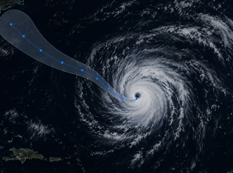
A hurricane tracking map shows a tropical cyclone’s current position, its forecast path, and its category, updated as the storm moves. Hurricane for iPhone gives you that map, with tap-to-open details for path, category, and where the storm is forecast to go next, for any active tropical cyclone, including typhoons in the western Pacific.
Path
Category
Storm surge
Watch vs. warning
Hurricane watch vs. hurricane warning: how much time you have
A hurricane watch means hurricane conditions are possible in the watch area, based on the storm’s current forecast track and intensity. A hurricane warning means those conditions are expected. Landfall has not been confirmed at either stage, unlike a tornado warning, which is issued once a tornado or the rotation that produces one has been spotted or detected on radar.
What sets these apart from tornado and thunderstorm alerts is what triggers them. A tornado warning follows something detected right now, close to you. A hurricane watch or warning follows a forecast track that can still shift, which is why the map matters as much as the alert text. The same watch, warning, and advisory system works across every other hazard — see severe weather alerts.
The same watch and warning pair carries over to Typhoon Watch and Typhoon Warning for tropical cyclones outside the Atlantic.
Hurricane Watch
Conditions are possible on the current forecast track, usually 48 hours before tropical-storm-force winds arrive. Review your evacuation plan and secure loose outdoor items.
Hurricane Warning
Conditions are expected in the warned area, usually 36 hours before tropical-storm-force winds arrive. Complete preparations and follow evacuation orders from local officials.
Hurricane categories
The Saffir-Simpson Hurricane Wind Scale groups hurricanes into five categories by sustained wind speed. It is the standard classification the National Hurricane Center uses, and it is what the category number on the map refers to.
Category 1 covers sustained winds of 74–95 mph; Category 2, 96–110 mph; Category 3, 111–129 mph; Category 4, 130–156 mph; and Category 5, 157 mph or higher.
Category is about wind alone; it does not describe storm surge or rainfall flooding, which are tracked as their own alert types.
A tropical cyclone shows up on the map with its full forecast path drawn out. Tap the storm for its category, its recent track, and where the forecast has it heading next.
Saffir-Simpson scale
Cat 1 · 74–95
Cat 2 · 96–110
Cat 3 · 111–129
Cat 4 · 130–156
Cat 5 · 157+
Category 3 and above is classified as a major hurricane.
Precipitation intensity
Light
Moderate
Heavy
Live radar
Rain bands, wind, and the track on one map
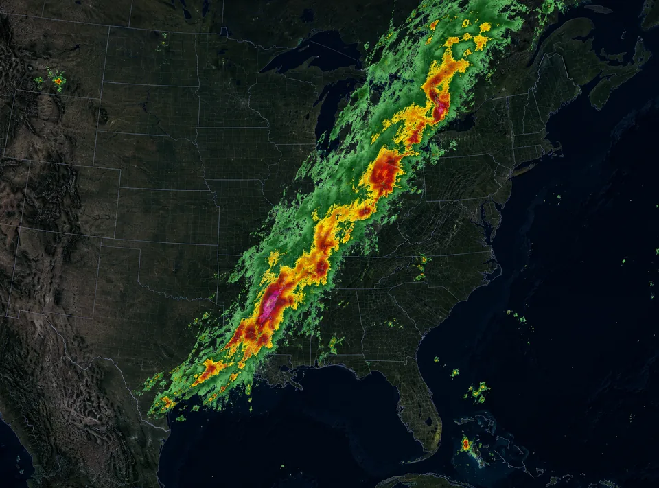
The Tropical Cyclones layer sits on the same map as live weather radar and wind animation, so you can see the system’s structure and the winds steering it, not only a projected line.
Play the radar timeline forward to watch the outer bands arrive, and tap anywhere on the map for conditions at that exact point. Coverage is not limited to the Atlantic: the wind layer and Radar Global work worldwide.
See what live weather radar shows
Tornado
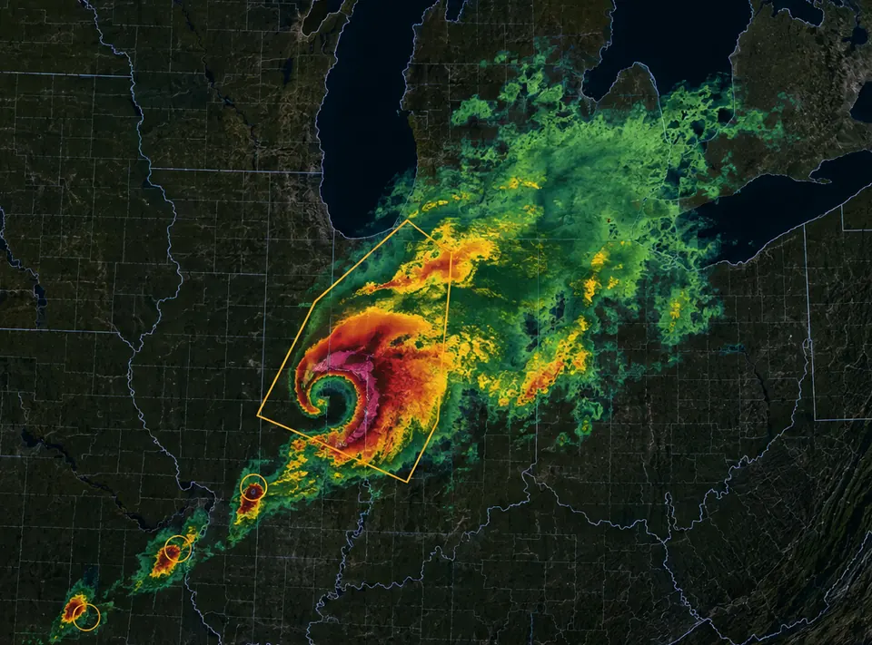
Landfalling storms can spawn tornadoes inland
A hurricane or tropical storm making landfall can also produce tornadoes well inland from the coast, hours after the wind at the shore has eased.
A watch means conditions could produce a tornado. A warning means one has been seen or picked up on radar, and it applies to a specific area, not a whole state.
See how tornado tracking works
What a tornado alert means
Tornado Watch
conditions could produce one
Tornado Warning
one has been seen or detected. Take shelter
Storm Surge Warning
now
Charleston County, SC. Life-threatening inundation is possible.
Tropical Storm Watch
6h ago
Miami-Dade County, FL. Tropical storm conditions are possible.
Hurricane alert levels
Advisory
be aware
Watch
conditions are possible
Warning
happening, or about to
Severe weather alerts
Save the locations in a storm’s way and Hurricane keeps watching them, even when the app is closed. An alert icon appears on the map next to a saved location when a hurricane, tropical storm, or storm surge alert is active nearby.
Severe weather alerts cover tornadoes, hurricanes and tropical storms, severe thunderstorms, winter storms and blizzards, ice, extreme cold and heat, wildfire danger, and air quality. In the United States, alerts are sourced from NOAA and the National Weather Service.
See every alert type we cover
I truly appreciate having access to this information when I need it. I am responsible for two senior care homes and this weather tracker helps me stay informed and in control.
mvlgg
App Store
Nicely integrates multiple wether elements, radar returns, wind, frontal boundaries to give a dynamic presentation of weather
daytexas
App Store
This app works great, accurate forecast, easy to view and understand, wonderful instant weather viewing
Chinger12
App Store
What is the difference between a hurricane watch and a hurricane warning?
A hurricane watch means hurricane conditions are possible in the area, based on the storm’s forecast track and intensity. A hurricane warning means those conditions are expected. Both follow a forecast that can still shift as the storm moves.
What do the hurricane categories 1 through 5 mean?
The category number comes from the Saffir-Simpson Hurricane Wind Scale, which classifies hurricanes by sustained wind speed, from Category 1 (74–95 mph) to Category 5 (157 mph or higher). Category 3 and above is classified as a major hurricane.
What is the difference between a tropical depression, a tropical storm, and a hurricane?
These are the same type of storm system at increasing strength, classified by sustained wind speed. A tropical depression has winds under 39 mph, a tropical storm has winds from 39 to 73 mph, and a hurricane has winds of 74 mph or higher.
Does Hurricane track storms outside the Atlantic, like typhoons?
Yes. The storm tracker covers tropical cyclones outside the Atlantic, and supports Typhoon Watch, Typhoon Warning, and Typhoon Local Statement alerts in the Pacific. The wind layer and Radar Global also work worldwide.
What is storm surge, and why is it different from the hurricane’s category?
Storm surge is the rise in ocean water pushed onshore by a storm, and it is a separate hazard from wind. Category describes sustained wind speed alone; a lower-category storm can still produce dangerous storm surge.
What information do I see when I tap a hurricane on the map?
Tapping an active tropical cyclone opens its details: current category, recent track, and the forecast path showing where it is expected to head next.
Hurricane is free to download. Premium features are available in-app.